A measured building survey can range in scale and complexity depending on various factors.
A simple survey may be used for maximising the use of office space or small cosmetic alterations. A more complex measured building survey can be required for redevelopment of existing buildings, planning applications or for historical record of listed buildings.
The techniques utilised for data capture of a measured building survey vary on the complexity of the task.
For simple sites the data can be captured with tape measures and electronic distance measuring devices. The resulting plans can then be delivered in an electronic format by our CAD team.
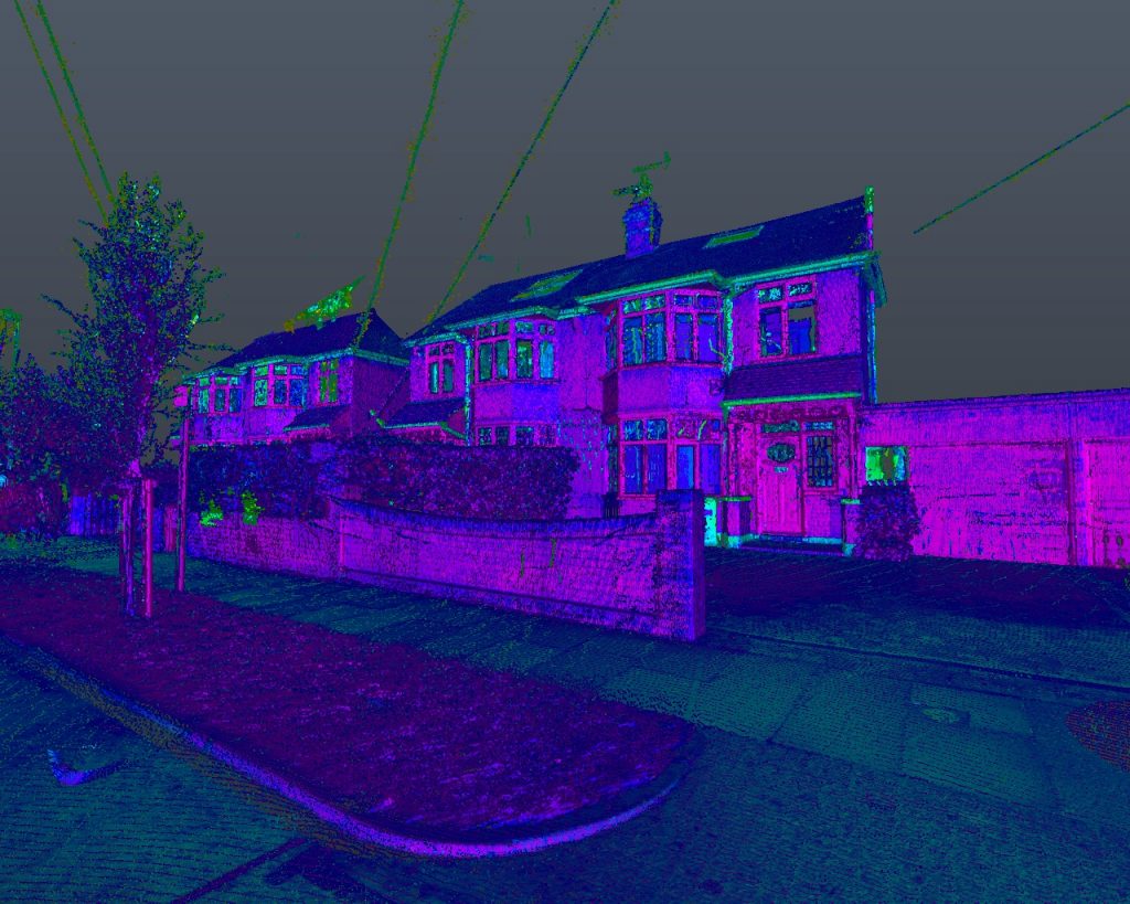
For more complicated measured building surveys, a 3D terrestrial laser scanner is used to capture millions of points to mm accuracy, creating a point cloud for use in the design and evaluation processes.The typical environment where a measured survey would be required is a for an existing building. Increasingly they are being used in a varied scope of applications due to the quantity and quality of the resulting data.
We can provide everything from measurement checks for rental area purposes to fully detailed floor plans, sections and elevations. Topographic survey data can also be extracted from a scanned survey for the creation of digital ground models and accurate drawings.
Combining our measured surveys with our confined spaces trained personnel we can provide a unique service allowing accurate data to be captured for areas where others are unable to reach, for example 3D laser scans of tunnel networks or culverts.
Where required our 3D information can be recorded using OSGB36 GPS coordinates. Making our measured building survey data available as a geo-referenced data set enables the client to insert it into any required existing models.
A consistent approach to data collection, management and presentation means we can provide any scale of measured building survey to a standard and specification that the client is familiar with.
All of our project outputs are fully compatible with the suite of Autodesk products. Our point cloud data can be imported directly in to Autocad or Revit. Alternatively we can provide a completed Revit model of one of our scanned point clouds.
A measured survey is where data is captured to allow us to provide an accurate representation of the asset being surveyed. There are many ways of achieving this from simple measurements using tape measures and electronic distance measuring devices through to a full 3D laser scan of the survey area.
Insight – Telecommunications Sector
A suite of complementary services aimed squarely at providing customer…
Free PAS 128 Autumn Webinar 2020
PAS 128 is the underground utility survey industry standard. We…